
Search McLennan County Streets
Use a complete McLennan County address first: number, street name, suffix, direction, unit, place, and ZIP. The county tax portal accepts a property address that starts with the supplied text. Save the tax account, CAD reference, parcel identifier when shown, situs address, mailing address, owner name, and retrieval date. Those items make later matches more reliable. A parcel owner is a recorded tax role, not proof that the person now occupies the address.
- Run the address in the McLennan County tax search and record the account or CAD reference with the situs address.
- Open the same parcel through the MCAD map tools, then compare nearby parcels, neighborhood or subdivision context, and the mailing address.
- Use the owner or grantee name in the county clerk's Official Public Records index. Read the instrument type, recording date, legal description, and prior party before drawing a connection.
- For a voter-related lead, use Texas's published lookup and public-information routes with their protected-address limits. A public voter record does not reveal a ballot choice.
- When the address is historical, check reverse or criss-cross pages in the Waco directory volumes, then date the result against the directory year.
The resulting chain is address to parcel, owner name, deed role, voter record where lawful, and dated directory evidence. It is useful for family history, estate work, and confirming a seller's public record trail. It is not a household roster.
McLennan County Tax Address Fields
The county tax portal offers five starting categories: owner name, property address, account number, CAD reference number, and fiduciary number. It also permits an optional second criterion from the same categories. An address search is the practical opening for a street directory search because it returns a property record rather than a general name result. Keep the returned owner and both address forms separate.
| Portal field | Input | Required | McLennan County use |
|---|---|---|---|
| Search box | Text | Yes for first search | Owner last-first, address starts-with, account, CAD reference, or fiduciary. |
| Second search box | Text | Optional | Uses the same five categories to combine criteria. |
| Portfolio | Action | Optional | Supports up to 50 tax accounts in the payment workflow. |
| Result owner | Returned text | Result field | Tax or appraisal owner, not a guaranteed occupant. |
| Situs and mailing | Returned text | Varies by result | Record each separately and date the search. |
That last distinction matters. A tax notice can go elsewhere, and a person who appears in a tax result can be an owner, fiduciary, trust, estate, or business. The tax office notes an online roll gap for 2007 through 2014, so a missing online result from those years needs a records-office follow-up rather than a conclusion.
The tax portal shows the address-led interface used for a McLennan County street directory search.
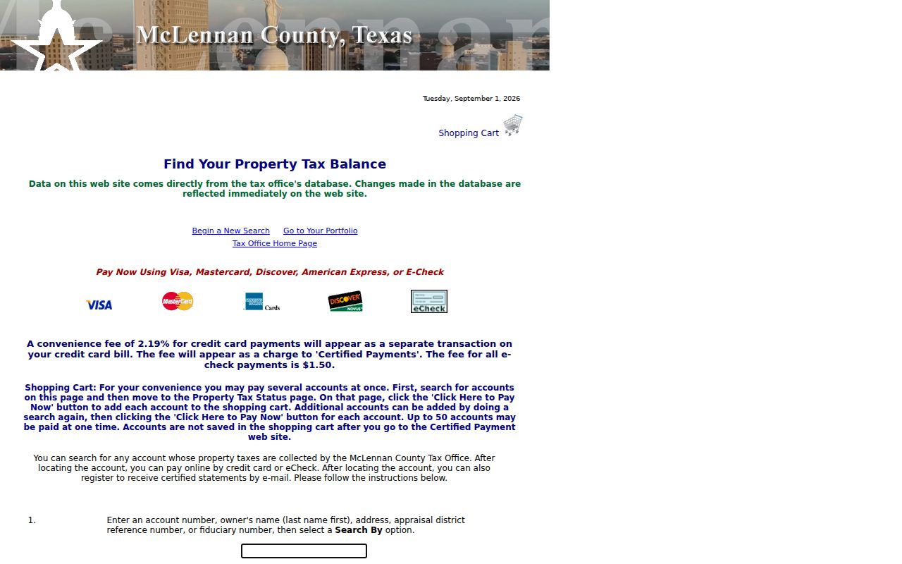
The captured fields show why a record identifier should travel with the address before the search moves to maps or deeds.
McLennan County Tax Owner Limits
A tax-owner result is not automatically the current occupant. MCAD and tax data identify an owner and parcel record, while an occupant may be different or may not appear in any public address source. Do not use a mailing address as a substitute for the parcel's situs, and do not turn an owner result into a statement about every person at the property. This property-record distinction prevents a common address-search error.
MCAD offers a written request to remove personal information from its website. The district says removal from its website does not remove the material from other public or electronic sources, and spelling variations can create more than one owner ID. That is a limited privacy route, not a way to erase a public-record trail.
MCAD's website-removal request form documents the information needed for that local request.
The form reinforces that parcel data and privacy choices have separate custodians and limits.
McLennan County Street Map Tools
After locating the account, the MCAD map search can use an account number, a person or business name, or a street address. It also offers neighborhood, subdivision, Mapsco, radius, map-analysis, and export controls. The Waco GIS McLennan County MapServer provides parcel, PID, boundary, neighborhood, historic, and other overlays. Map tools can show the geography around an address; they do not create a list of everyone who lives on a block.
| Account number | A positive integer of up to 10 digits for one MCAD parcel. |
|---|---|
| Name or address | Searches all or part of a person, business, or street address. |
| Neighborhood or subdivision | Selectors that narrow map geography. |
| Mapsco or radius | Map-reference and browse tools; radius can be enabled and reset. |
| Find, Analyze, Export | Post-search controls that select properties, show up to 1,000 analysis rows, and export results. |
Use the map to verify that an address and parcel are in the intended McLennan County area, then return to the property account and recorded instrument. Neighboring-parcel selection is a geographic tool, not a proof of shared household ties.
Waco GIS McLennan County MapServer provides the layers used to check parcel and boundary context.
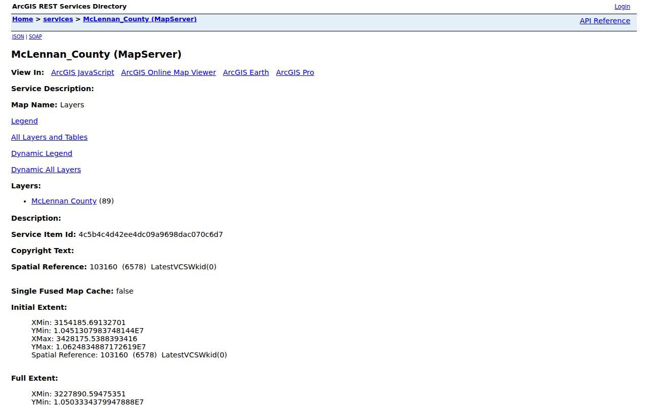
Its map-service view supports a parcel check after an address is normalized, without converting map proximity into a resident claim.
McLennan County Deed Search Roles
The county clerk lists deeds, deeds of trust, liens, releases, assumed names, powers of attorney, affidavits, plats, and related instruments in Official Public Records. Search begins with a grantor or grantee because the county clerk FAQ says there is no legal-description index. Try both name orderings, initials, and spelling variants. Then inspect the image and legal description instead of relying on a search hit alone.
Grantor means the conveying party and grantee means the receiving party. Either can be a person, estate, lender, trustee, company, or agent. Record the instrument type, execution and recording dates, book or document citation, legal description, and related releases or assignments. That record trail gives a street directory a dated property connection, not a current-resident label.
McLennan Central Appraisal District is the official starting point for its public property and map services.
The appraisal district view belongs at the start of the address chain, before a party-name deed search adds historical context.
Note: Electronic OPR access begins in 1996, while older books, Archives, and microfilm carry much of the earlier trail.
McLennan County Address Record Coverage
Several McLennan County systems can be keyed to an address, parcel, or recorded party. They overlap but do not mean the same thing. The tax record supports an owner and account trail. MCAD and GIS add parcel and map context. Official Public Records connect parties to instruments. Voter information has separate statutory limits, and permit history lacks a stable public search with a confirmed field list. The table keeps the street-by-street roles distinct.
| Address record | Local keeper | What it can show | Documented access |
|---|---|---|---|
| Tax roll or account | County Tax Office | Owner, account, tax-year, mailing and situs clues | Online portal; county notes a 2007–2014 gap. |
| Appraisal parcel | MCAD | CAD or PID, owner, parcel, map, and value context | Public map search with disclaimer and export controls. |
| Deed and OPR | County Clerk and Archives | Recorded party roles, legal description, transfer chain | Electronic index from 1996; books and archives for older records. |
| GIS layers | Waco GIS and county mapping | Parcel, boundary, neighborhood, and infrastructure overlays | Public map service subject to query limits. |
| Permits or code | Appropriate city or county custodian | Address activity and possible applicant or owner | Request by street address; no stable public field list was located. |
A full named-street search may move through many parcels, but each parcel needs its own date and identifier. For a past occupant rather than a current property trail, the dated volumes discussed with the McLennan County city directories are the narrower historical source.
McLennan County Voter Address Limits
Texas My Voter Portal uses a VUID, a first and last name with county, or eligible Texas driver-license information. It is not a ZIP or street-browse tool. Public voter information can include name, VUID, precinct or status, participation history, and regulated address fields, but election participation is not a ballot choice. A voter status is time-sensitive and should be dated when used as a matching clue.
Protected voters and addresses need special handling. Texas address-confidentiality guidance describes suppression programs, and a protected address must not be reconstructed from tax, deed, court, or map results. For a formal county or district voter-file request, the state public-information form requires requested county or district, delivery method, affidavit or notary material, contact details, and a deposit. It is not a casual street-list request.
Note: Use only the public fields and access channel that Texas authorizes, and never infer a protected address from another record.
McLennan County Address Labels
Address terms change how a record should be read. The parcel's physical location, the address used for notices, and the legal land description can point to different places or describe the same property in different ways. Older deeds and directories may use a rural route, box, landmark, or legal description, while current tax, MCAD, and GIS records use a standardized situs address.
- Parcel
- A defined piece of land in the appraisal and map system, commonly tied to an account or CAD/PID.
- Situs address
- The physical address of the parcel, distinct from an address for tax notices.
- Plat
- A recorded map or plan associated with a subdivision or tract; it is an instrument-related land record, not an occupancy list.
- Criss-cross directory
- A reverse directory arranged by street and number, used to locate a dated directory entry by address.
When an old address fails in a current database, bridge it through the legal description, map sheet, street index, and parcel identifier. The inspected sources did not document a verified countywide renumbering year, so an unverified change should not be asserted as fact.
Historic McLennan County Street Leads
Historical address work can use Waco directories held by Baylor and TSLAC, plus County Archives and microfilm. A reverse or criss-cross page can supply a dated household or business lead, but the directory year governs its meaning. Pair that entry with a parcel legal description, a deed date, or a map sheet before deciding that two address forms refer to the same place.
County history also explains why a hybrid search is normal. McLennan County was created in 1850, and the first Commissioners Court minutes began that September. Bound volumes, microfilm, archival rooms, electronic indexes, and map services each preserve different portions of the trail. A missing online record can point to a book or reel, not to the absence of a county record.
McLennan County Street Directory Limits
A McLennan County street directory cannot show every household member, private utility customer, or protected voter. It also cannot turn a deed party, tax owner, association contact, or map label into proof that a person currently lives at an address. Keep the source role, date, office, and record identifier with the result. A second independent source should support any meaningful address conclusion.
MCAD's removal route, voter-address protections, sealed and restricted records, and redactions have different rules. Respect the custodian's limits even when another index contains a related name or parcel reference.
McLennan County PIA Address Requests
When an address record is not in a stable public portal, the documented fallback is the custodian, not guesswork. The County Clerk has electronic public workstations at 215 N 5th Street, Rooms 223 A&B, Waco, and keeps older material in books. County Archives and TSLAC microfilm provide older access channels. Permit and code history should be requested from the city or county custodian that holds it.
Under the Texas Public Information Act request guidance, a request should be written and directed to the governmental body. The request seeks existing information; it does not require an agency to create a record or conduct research. Mail, email, hand delivery, or another authorized method may be used. Narrow the request to a record series, date range, address, and known account or instrument number.
Electronic delivery can be requested when available. For older material, ask whether inspection, a copy request, archive retrieval, or microfilm is the appropriate route. The county clerk FAQ lists 215 N 5th Street, Rooms 223 A&B, Waco, phone 254-757-5078, with Monday through Friday hours of 8 to 5.